Can you 3D print a map of Mount Kilimanjaro?
Can you 3D print a map of Mount Kilimanjaro? Yes. Learn how terrain data and your GPX route create a personal keepsake, plus what to check before ordering.
Article
Yes, you can 3D print a map of Mount Kilimanjaro using elevation data to model the mountain and GPS route data to show a particular climb. The distinction is that a GPX track describes your route; it does not supply the surrounding mountain terrain by itself. For a summit keepsake, choose a terrain model with your actual ascent and descent rather than assuming a generic mountain model includes your trek.
- Can you 3D print a map of Mount Kilimanjaro? Yes—combine elevation data with a GPS route for a personalized keepsake.
- Printmyroutes makes custom topographic route sculptures from GPX uploads or Strava activity data.
- Choose terrain alone for the mountain’s shape; choose terrain plus your track to commemorate your climb.
- Check the route, terrain crop, and summit position before approving a model for printing.
Why this matters
A recognizable mountain and a faithful record of your climb are different things. A terrain-only sculpture shows the landscape, but it does not identify where you walked, where you turned around, or which descent you took.
For a 2026 summit gift, start with the person’s trip rather than the mountain’s name. Printmyroutes makes custom topographic route sculptures from GPX uploads or Strava data, so a recorded activity is a useful starting point for a personalized keepsake.
Choose the route first, then frame the mountain around it. That decision keeps the sculpture focused on the achievement instead of producing a generic landscape with an unrelated line added later.
Can you 3D print a map of Mount Kilimanjaro?
Yes. A printable Kilimanjaro map combines a digital terrain surface with a solid model that a printer can manufacture. If you want a personal climbing keepsake, the model also needs the correct route positioned on that surface.
Kilimanjaro’s highest point, Uhuru Peak, is 5,895 meters above sea level, approximately 19,341 feet, as listed by Tanzania National Parks. That elevation describes the real summit—not the height of the finished sculpture or the amount of relief a print should use.
There are two useful approaches. Neither is automatically better; the right choice depends on what you want the object to remember.
| Map approach | Best for | Main advantage | Main limitation |
|---|---|---|---|
| Terrain-only model | Someone interested in Kilimanjaro’s landscape | Shows the mountain’s shape without requiring a personal activity file | Does not document an individual climb |
| Terrain with a personal route | A trekker commemorating an ascent or turnaround | Connects the landscape to the actual journey | Requires checking the track for missing sections and recording errors |
For a personal summit keepsake, terrain with the climber’s own route is the better fit. For a landscape display, terrain alone avoids implying that an unverified track belongs to the recipient.
How do you turn a Kilimanjaro route into a printable map?
The practical sequence is to select the activity, check its path, choose the terrain boundary, review the model, and then authorize printing. These are preparation steps, not a promise that every ordering service offers the same controls.
- Choose the activity. Find the GPX file or Strava activity that represents the trek you want to preserve. Decide whether the sculpture should show the full journey or a particular section.
- Check the track. Look for missing days, long straight lines across unrecorded sections, and stray points away from the trail. Preserve the original file before requesting edits.
- Set the boundary. Include enough terrain to make the route understandable. A tight crop emphasizes the trail; a wider crop gives more mountain context but makes the route smaller at the same display size.
- Review the model. Ask to see how the route sits on the terrain. Check the summit, starting point, endpoint, and any personalization before approving production.
- Approve printing. Confirm the agreed model and order details. Keep a copy of the approved preview or specification so the intended result is clear.
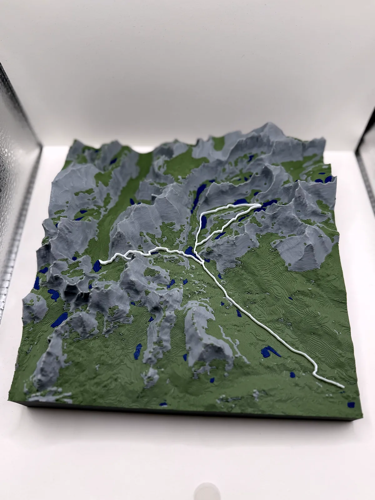
A GPX file is an input, not a ready-to-print object. The guide to 3D printing a GPX file explains that distinction before you commit to a particular file or workflow.
Terrain-only map: best for the mountain itself
Choose a terrain-only map when the mountain is the subject and a personal route is unnecessary. This approach suits a landscape keepsake or a gift for someone whose original activity recording is unavailable.
The advantage is straightforward: the model does not depend on a clean personal track. The limitation is equally clear: it cannot establish which trail the recipient followed or whether the displayed terrain corresponds to their entire trek.
Ask what geographic area the model includes. A summit-focused crop and a wider mountain view tell different stories, even when both accurately represent their selected terrain.
Recommendation: choose terrain alone when you want Kilimanjaro, not a record of a particular climb. Do not attach a generic route and describe it as the recipient’s actual journey.
Terrain with a personal route: best for a climbing keepsake
Choose a route-based map when the meaningful detail is the journey across the mountain. Your track can distinguish an ascent from the descent and preserve the actual endpoint rather than an assumed summit finish.
The strength is personal relevance. The constraint is data quality: a missing recording remains missing unless another trustworthy source supplies that section, and edits need to be deliberate rather than invisible.
Printmyroutes is best for hikers seeking a custom topographic route keepsake from GPX or Strava data. For a Kilimanjaro request in 2026, confirm that the intended file, terrain coverage, and presentation can be used before placing the order.
If you are buying a surprise gift, ask for the activity without guessing the route. A trip companion can help identify the correct recording, but a route with the same name is not proof that it matches the recipient’s climb.
Recommendation: choose the personal route when the gift commemorates what the hiker actually completed. A turnaround, alternate descent, or shortened trek still belongs in an honest keepsake.
Why the finished Kilimanjaro map varies
The same mountain can produce very different physical models. These decisions affect what you see and how closely the sculpture communicates the intended trip.
- Terrain coverage. A wide boundary includes more landscape. At the same physical size, it leaves less room for individual trail details.
- Elevation-data resolution. The terrain source limits the detail available to model. Enlarging a coarse surface does not recover features absent from the source.
- Route quality. Gaps, misplaced GPS points, and unrelated activity sections affect the line shown on the model. Review these before treating the track as final.
- Vertical scaling. Increasing the vertical scale relative to the horizontal scale makes slopes more prominent but changes the mountain’s proportions.
- Print geometry. Small terrain features and narrow route marks must be representable in the chosen physical print. A detailed digital preview is not, by itself, proof that every feature will print distinctly.
- Personalization. A summit label, trip date, or dedication changes what the object communicates. Request only the wording and options the seller confirms.
For your 2026 order, compare the proposed result with your purpose. A dramatic mountain profile and a readable multi-day route are different design priorities; ask which one the selected model emphasizes.
What should you check before ordering a Kilimanjaro sculpture?
Use the preview as a proof, not just a picture. The most useful checks establish whether the model represents the right place, the right journey, and the right person.
Confirm the journey
Check the start and finish against the original activity. If your trek spans several recordings, identify their order and ask whether they can be combined without adding unsupported connecting segments.
Also decide what the route should exclude. Travel before the trek, an unrelated walk, or an accidental recording after the finish can distract from the mountain journey.
Confirm the terrain proportions
Ask whether the model uses matching horizontal and vertical scales or exaggerates the relief. Neither presentation is inherently wrong for a keepsake, but they answer different expectations.
For example, at a horizontal scale of 1:100,000, 1 centimeter on the model represents 1 kilometer on the ground. This is a scale explanation, not a recommended product dimension; ask for the actual model’s scale if geographic proportions matter to you.
Confirm the words
Check the spelling of the recipient’s name, the route name, and the trip date. If the inscription includes a summit claim, make sure that wording matches the journey rather than the gift-giver’s assumption.
Use 2026 only for a trip that happened in 2026. An ordering date does not replace the date of the climb, and an undated dedication is better than an incorrect year.
Confirm the practical details
Ask about the material, finished dimensions, personalization choices, and production arrangements for the specific request. Do not infer them from another mountain sculpture or an unrelated example.
For a time-sensitive gift, establish the required arrival date before approving production. A custom route keepsake should not depend on an assumed turnaround.
Discuss your Kilimanjaro route
Ask about your GPX file, terrain coverage, and personalization before ordering.
Can I use my Strava activity for a Kilimanjaro map?
Yes, Strava activity data can supply a route for a personalized topographic sculpture. Check that the selected activity contains the section you want to commemorate rather than assuming one recording covers the entire trek.
An activity track and the surrounding terrain serve different purposes. The track shows the journey; a separate elevation surface supplies the mountain shape.
Do I need the entire trek in one GPX file?
No, the original recordings do not have to begin as one file, but the final route needs a clear, agreed structure. Ask how separate recordings will be handled before submitting a multi-day trek as a single project.
Keep the originals and identify any gaps. Joining recordings should not silently turn an unrecorded section into a claimed path.
Is a printed Kilimanjaro map accurate enough for hiking?
A decorative terrain sculpture is a keepsake, not a substitute for current navigation resources. Its crop, physical size, vertical scaling, and route treatment affect what it can communicate.
Use the sculpture to remember the trip. Use appropriate current maps and navigation resources to plan or follow a route.
FAQ
Can you 3D print a map of Mount Kilimanjaro without a GPS recording?
Yes, a terrain-only Kilimanjaro map does not require your personal GPS recording. To represent your actual climb, you need a trustworthy route source rather than an assumed trail.
What's the best Kilimanjaro map gift for someone who climbed it?
A terrain map with the climber’s actual route is the best fit when the gift is meant to commemorate that journey. Confirm the ascent, descent, and endpoint before approving the model.
Can Printmyroutes use a GPX file or Strava activity?
Printmyroutes makes custom topographic route sculptures from GPX uploads or Strava data. Confirm the details of a Kilimanjaro request before ordering.
Will a GPX file include the whole mountain?
No, a GPX track does not contain a complete terrain surface for the surrounding mountain. It supplies route information that must be combined with elevation data for a topographic model.
Can I include the descent as well as the ascent?
You can request both the ascent and descent when the route data contains them. Ask how overlapping sections will be shown so the finished route remains understandable.
Should the sculpture show a summit if the hiker turned around?
The sculpture should show the journey the hiker actually completed. Keep the recorded endpoint and use wording that celebrates the trek without claiming an uncompleted summit.
Can I print a Kilimanjaro map on my own printer?
Yes, you can print a suitable terrain model on a compatible printer. A GPX file alone is not that model; terrain preparation, route placement, and printable geometry still need to be handled.
One last thing
Do not fix a memorable detour out of the route just because it looks untidy. A GPS error and a real deviation are different: remove the error only after checking it, and preserve the deviation if it was part of the climb.
Before approving the sculpture, ask the hiker which moment matters most. The summit is an obvious focal point, but a turnaround, a difficult traverse, or the final descent can be the detail that makes the object theirs.